Resource & Infrastructure
Make more accurate decisions with the most precise data available. Strategic Natural Resource Group’s systems, including GIS, RPAS and Lidar, offer the ability to make more informed decisions through enhanced data collection, interpretation, dissemination, visualization and analysis.
Utilities, Renewables, Oil & Gas, Mining
Planning, LiDAR acquisition and processing, geotechnical and engineering, and access road location, design, permitting, environmental monitoring and construction supervision.
Resource Management
Taking an environmentally, socially and economically balanced approach to resource management.
Advanced Geomatics
Make more accurate decisions with the most precise data available. We utilize leading-edge technology for our Geographic Information Systems (GIS) and Remotely Piloted Aircraft System (RPAS) services.
Utilities, Renewables, Oil & Gas, Mining
Planning, LiDAR acquisition and processing, geotechnical and engineering, and access road location, design, permitting, environmental monitoring and construction supervision.
Access Planning & Route Optimization
- LiDAR and Field-Based Route Planning – Develop and optimize access roads using LiDAR and on-ground field assessments.
- Access Design and Integration – Ensure efficient access integration routes, mining operations, pipelines, and hydro/solar/wind infrastructure.
- Constructability & Terrain Analysis – Coordinate geotechnical, environmental, and bridge site plan surveys to refine road alignment.
- Construction cost estimates
Infrastructure & Construction Support
- Road & Bridge Engineering – Identify, design, field-mark, and oversee construction of new and reconstructed access roads and bridge crossings.
- Specialized Construction Techniques – Develop custom road construction
techniques, material storage solutions, and mitigation plans for challenging terrain. - Penstock & Transmission Line Coordination – Align access corridors with power transmission lines and hydroelectric penstock placement for efficiency.
Project Oversight & Management
- Coordinating Registered Professional (CRP) – Manage multidisciplinary teams to ensure IFC (Issued for Construction) approvals and project success.
- Professional of Record (POR) & Engineer of Record (EOR) – Provide technical
oversight and compliance monitoring during construction. - Construction Supervision & Quality Control – Monitor contractor progress, budget targets, schedule adherence, and regulatory compliance.
Environmental & Regulatory Compliance
- Permitting & Regulatory Support – Assist with access road, bridge, and linear corridor permitting.
- Stream & Watercourse Management – Conduct stream sampling, classification, and crossing structure selection.
- Reclamation & Environmental Mitigation – Develop site-specific reclamation
plans for restored access and disturbed areas.
Logistics & Resource Management
- Camp, Laydown, & Site Infrastructure – Plan and manage construction support
infrastructure, including camps, laydowns, and helipads. - Equipment & Material Procurement – Support RFP/RFQ processes for culverts, bridges, and aggregate production.
- Timber Cruising & Valuation – Assess timber volume and values for clearing access routes
and infrastructure sites.
Stakeholder Engagement & Collaboration
- Indigenous & Community Collaboration – Work with First Nations and local communities on training and access-related fieldwork.
- Contractor & Subcontractor Management – Oversee prime contractor and
subcontractor performance, ensuring quality and efficiency. - Liaison with Project Owners & Regulatory Bodies – Act as a key point of contact
for ownership, contractors, and government agencies.
Resource Management
Taking an environmentally, socially and economically balanced approach to resource management.
Full-Phase Timber Development
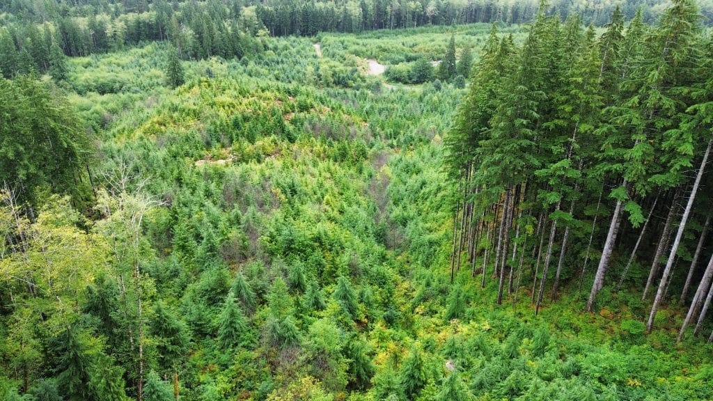
Strategic Natural Resource Group specializes in timber development on steeper ground, leveraging advanced technology and expertise to navigate challenging terrain efficiently. With offices in both the coast and interior, we offer a unique perspective on diverse forestry operations, ensuring solutions that are tailored to all types of landscapes and operational requirements.
- Full-Phase Timber Development
Utilizing innovative technology, Strategic’s groundwork becomes significantly more productive, bringing the most value in timber development for our clients. - Block & Road Layout, Riparian Assessments, and Bridge Site Plans
Registered professionals assist in conducting precise block and road layouts, riparian assessments, bridge site planning, and engineered cost estimates, ensuring operational feasibility and environmental compliance. - Timber Cruising
Comprehensive timber cruising services, including full appraisal cruising, private land assessments, and license-to-cut evaluations, conducted by Accredited Timber Cruisers and Evaluators. - Permitting & Appraisals
Expert foresters manage the permitting process and appraisals to streamline regulatory approvals and ensure compliance with industry standards. - Post-harvest
We provide comprehensive post-harvest services to ensure regulatory compliance, environmental stewardship, and operational efficiency. Our expertise includes change-of-circumstance inspections, deactivation and rehabilitation plans, harvest inspections and post-harvest sign-off, waste and residue surveys, and erosion and sediment control risk assessments. By leveraging innovative technology and industry best practices, we help clients navigate post-harvest requirements while promoting sustainable forest management.
Forest Landscape Planning
- We provide a comprehensive approach that integrates various factors such as ecological health, economic viability, and social implications to manage forest resources effectively. The process involves assessing the forest's current condition, determining sustainable harvest rates, and implementing strategies for regeneration and conservation. By considering long-term environmental goals alongside immediate resource needs, total chance planning ensures that forests are managed responsibly.
This holistic approach aims to maintain biodiversity, mitigate climate change impacts, and support local communities, ensuring that forests continue to provide ecological, economic, and recreational benefits for future generations. - Provincially pre-qualified Forest Landscape Planning modelling supplier
Forest Modelling
Our team delivers comprehensive timber supply analysis and strategic planning services to optimize your forest management decisions. With extensive experience in Timber Supply Reviews (TSRs) for Tree Farm Licenses (TFLs), First Nations Woodland Licences (FNWLs), and Community Forest Agreements (CFAs), we leverage advanced technical tools including SQL, Python, GIS, growth and yield models and forest estate models to provide data-driven solutions. Our expertise in land base summaries, growth and yield modelling and timber supply modelling ensures your desired forestry management objectives are translated accurately in the forecast to help you understand the unique land base characteristics through time. Through methodical analysis and strategic planning, we transform complex forest inventory data into valuable insights that balance forest stewardship with operational efficiency and economic objectives.
Our clients







Advanced Geomatics
Make more accurate decisions with the most precise data available. We utilize leading-edge technology for our Geographic Information Systems (GIS) and Remotely Piloted Aircraft System (RPAS) services.
GIS
Our services include: spatial analysis and mapping, data management, systems development, web mapping and field data collection, data reporting and visual impact assessments, and carbon modelling and analysis.
Remotely Piloted Aircraft Systems (RPAS)
Our RPAS team can deliver: LiDAR acquisition, aerial imagery acquisition, data processing and analysis, RPAS thermal and multispectral imaging, aerial surveying and mapping, volumetrics, and more.

